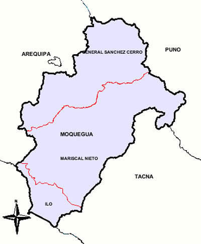
MAP OF THE MOQUEGUA DEPARTMENT - MAPA DEL DEPARTAMENTO DE MOQUEGUA

In the map of the Department of Moquegua, it is possible to be appreciated the three (03) provinces whereupon those that count.
En el mapa del Departamento de Moquegua, se puede apreciar las tres (03) provincias con que las que cuenta.
| PROVINCIA | DISTRITOS |
| MARISCAL NIETO | |
| 1 | MOQUEGUA |
| 2 | CARUMAS |
| 3 | CUCHUMBAYA |
| 4 | SAMEGUA |
| 5 | SAN CRISTOBAL(Calacoa) |
| 6 | TORATA |
| GENERAL SANCHEZ CERRO | |
| 1 | OMATE |
| 2 | CHOJATA |
| 3 | COALAQUE |
| 4 | ICHUÑA |
| 5 | LA CAPILLA |
| 6 | LLOQUE |
| 7 | MATALAQUE |
| 8 | PUQUINA |
| 9 | QUINISTAQUILLAS |
| 10 | UBINAS |
| 11 | YUNGA |
| ILO | |
| 1 | ILO |
| 2 | EL ALGARROBAL |
| 3 | PACOCHA(Pueblo Nuevo) |
NOTE: In the relation of the districts the names would only apareceran between parenthesis that do not agree with the district.
NOTA: En la relación de los distritos sólo apareceran entre paréntesis los nombres que no coinciden con el distrito.
Fuente: Instituto Nacional de Estadística e Informática
|
Web site created on march 30 of 2005.
© Copyright 2005 Gualberto Valderrama C.
|

